
FARM SUPPORT SERVICES
PLANNING
Our drones can accurately map your fields so you can plan everything from seed, treatment and labor quantities. We can help you decide where to plant each crop, show you where weeds are getting a foothold, which rows need feeding, and eventually, what to expect at harvest.
SEEDLING COUNTS
After you get started in the spring, we’ll take a look from above and show you exactly how emergence is coming, and how successful transplanting was. You can make a more informed decision on whether to replant or not, and you don’t have to walk the fields to find out. Time = money.
CROP PROGRESS
Are you fields developing the way you expect. Our specialized cameras can assess the growth rate over time, which will give you early warning of issues and help you set initial timing, labor, and market plans for harvest.
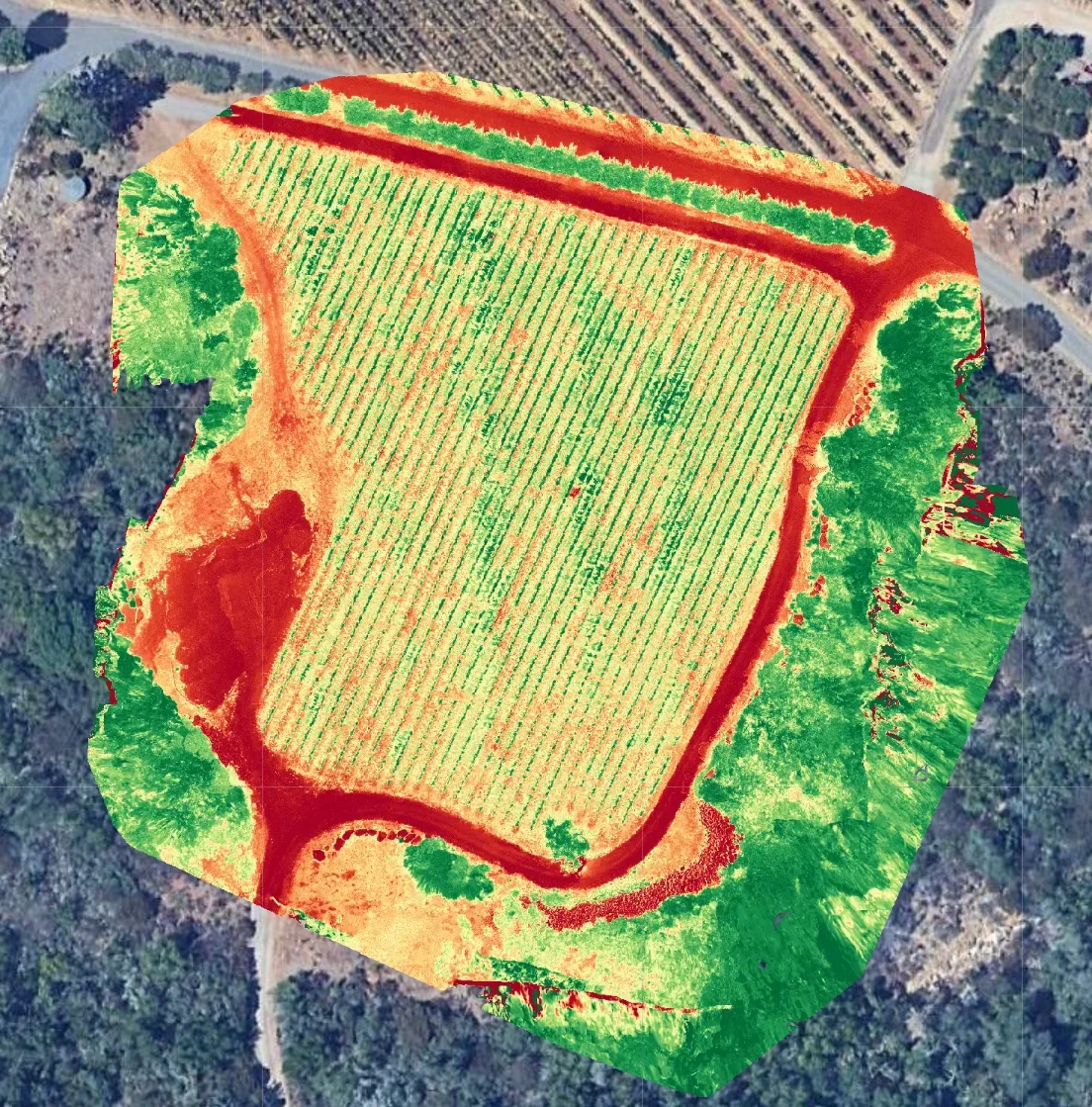
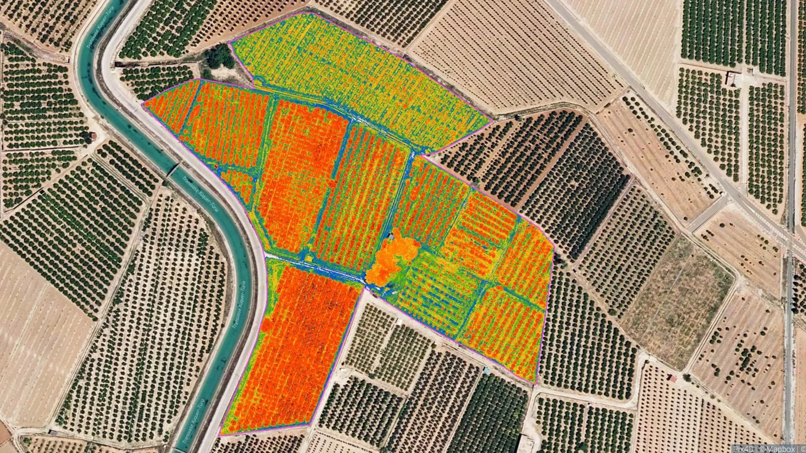
CROP HEALTH
The time to intercede is before a problem gets out of hand. Our drones can spot small pockets of distress before they affect the field around them. You don’t have to send crew out walking to find spots that aren’t always easy to see. It might be something like a nutrient deficiency, an insect arrival or a fungus.
IRRIGATION ISSUES
Water is a great thing. Except when it’s not. And it can be a problem when there’s too much, and obviously, when there’s too little. Summers in Maine are getting hotter and drier. Make sure you know whether the limited water you have is going to the right places.
DAMAGE ASSESSMENT AND INSURANCE CLAIMS
Sometimes, Mother Nature just decides to step on our plans. You may be able to make an insurance claim if storms, droughts and other natural calamities arise. There may even be times when a planting fails because of defective seed or other reasons. All of this is easily and accurately documented by our drones.
Copyright 2026 MainelyDrones LLC