About MainelyDrones
MainelyDrones can provide several types of aerial imaging. Each is tailored specifically to your needs. Our process is to spend time up front listening to you to understand your needs, and then delivering a product you are completely satisfied with. Our owner and chief pilot, Tom Tripp, is an FAA-licensed drone pilot with over a decade of experience flying drones. Our aircraft include drones that can take high-resolution photos and 4K HRD video. They can also inspect structures, construction sites, and roadways. They can create accurate, high-resolution orthomosaic photos, and 3D models for planning and creative efforts. We have drones that specialize in agriculture and environmental mapping and analysis, including the ability to take multispectral images and video to assess crop health and status.
Pricing is determined by the time it takes to prepare for the job, including travel if extensive; preparing the aircraft and safely executing the mission, and lastly the scope of deliverables. While we may ask for a deposit for large or especially complicated jobs, we will never ask for final, full payment until you are satisfied. We will quote the complete price, including all deliverables at the outset. There never any unexpected charges. We can accommodate requirements and budgets of all sizes. Tell us how we can help you.Some of our Deliverables
-
Drone Photography and Videography
-

Drone Inspection
-

Mapping and Orthomosaic Photography (sometimes called photogrammetry)
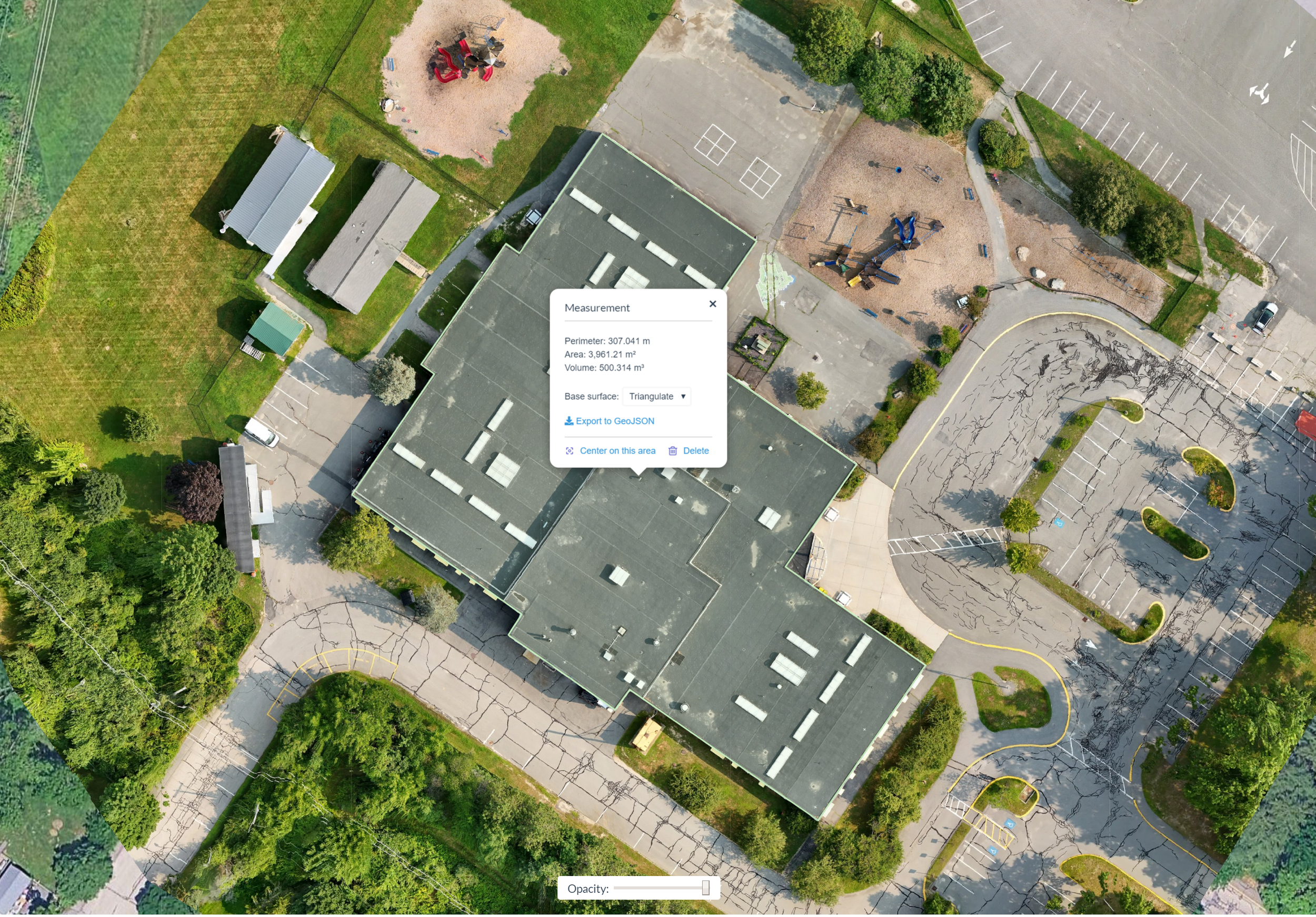
Roof Area Measurements from a 3D Model of a community center. Image and 3D Model by MainelyDrones.
Roof Work Status Check at local elementary school. High-resolution image by MainelyDrones.
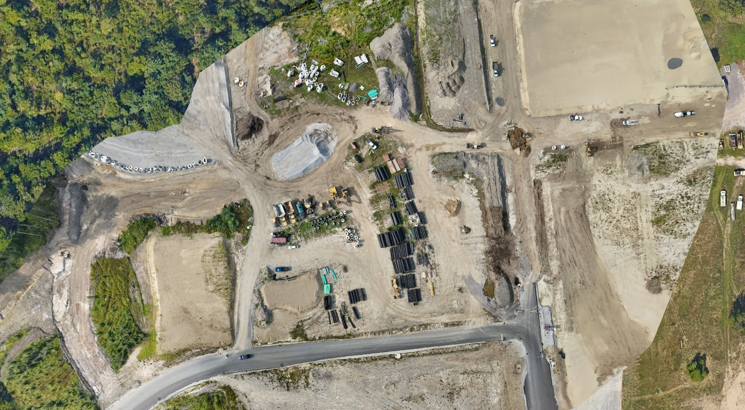
Static Image taken from 3D Model of Construction Site. Image and 3D model by MainelyDrones. This model can be used to calculate the size and volume of materials and earthworks.
Parking Lot Measurement for Reaving at Local Church. High-res orthomosaic image by MainelyDrones.
Roof Inspection and Area Measurements taken from an orthomosaic image by MainelyDrones.
Orthomosaic Drone Map of Construction Site by MainelyDrones. Using this image and 3D models, we can assess construction progress, the quantity of materials delivered, and amounts and volumes of earthworks.


